SUMMARY
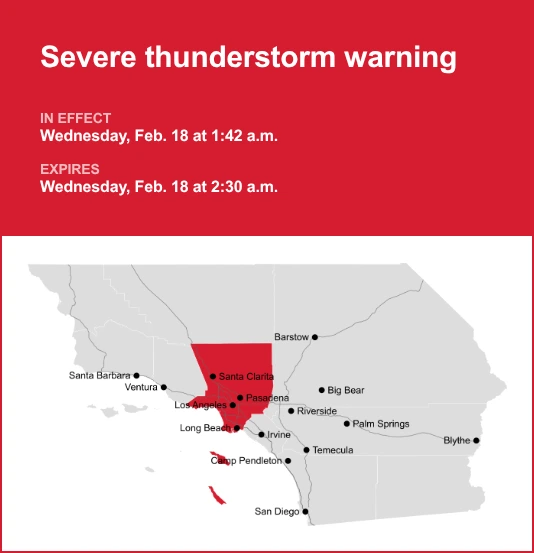
- A severe thunderstorm warning was in effect for Los Angeles County until 2:30 AM Wednesday.
- The National Weather Service warned of 60 mph wind gusts and possible tornado development.
- Emergency alerts, road closure updates and sandbag distribution were activated across Southern California.
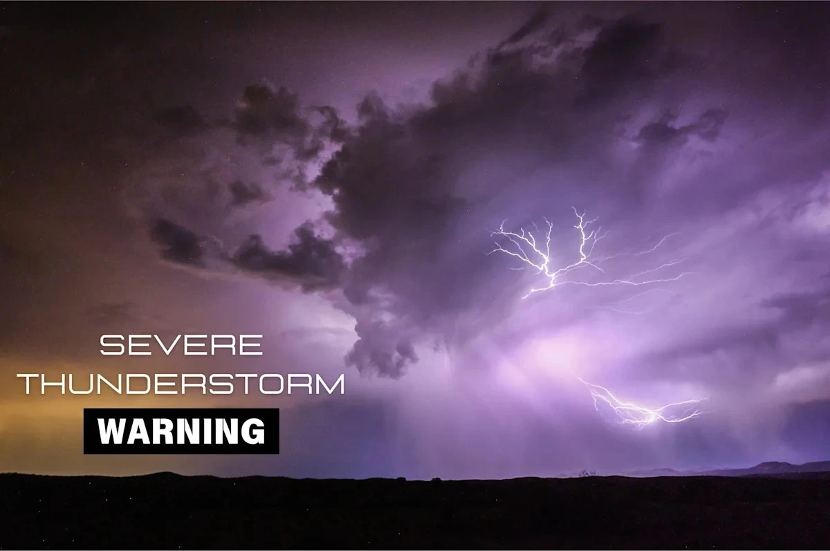
LOS ANGELES — Los Angeles County was placed under an updated severe thunderstorm warning early Wednesday after the National Weather Service reported fast-moving storms capable of producing wind gusts up to 60 mph, possible tornadoes and structural damage across densely populated communities.
The National Weather Service office in Oxnard said at 1:42 AM that severe thunderstorms were moving northeast at 100 mph along a line extending from Highway 138 between Interstate 15 and Highway 2 to near Carson.
The storms were expected to impact Long Beach, Pomona, Torrance, West Covina, Whittier and communities surrounding the Port of Los Angeles and Los Angeles Harbor. Officials warned residents to prepare for roof, siding and tree damage.
The warning underscores growing concern over rapidly intensifying storm systems affecting Southern California, where dense urban development increases the risk of property damage and power outages during high wind events.
While Southern California is better known for drought and wildfire risk, winter and early spring storm systems periodically bring intense rainfall, lightning and damaging winds.
According to the National Weather Service, lightning strikes the United States approximately 25 million times annually, causing about 20 deaths each year.
Local authorities have expanded emergency notification systems in recent years following destructive storms and wildfire driven evacuations.
Under current protocols, “considerable or catastrophic” hazards trigger wireless emergency alerts to enabled mobile phones across affected areas.
Transportation agencies also monitor flash flooding and debris flow risks, particularly in burn scar zones left vulnerable after recent wildfire seasons.
Rose Schoenfeld, a meteorologist with the National Weather Service in Oxnard, said the speed of the storm line increased its danger.
“Storms moving at 100 miles per hour reduce warning lead time and can intensify wind damage,” Schoenfeld said.
“Residents should treat a severe thunderstorm warning with the same urgency as other high impact weather alerts.”
Daniel Swain, a climate scientist at the University of California Agriculture and Natural Resources, said atmospheric river patterns and convective instability can combine to produce unusually intense weather bursts in Southern California.
“These hybrid systems can generate localized tornado threats and damaging straight line winds even outside the traditional tornado belt,” Swain said.
Emergency managers stress that urban infrastructure, including aging drainage systems and overhead utility lines, heightens vulnerability during severe thunderstorm warning events.
Lightning and Storm Risk in the US
| Metric | Current Estimate | Historical Context |
|---|---|---|
| Annual lightning strikes | 25 million | Largely concentrated in summer |
| Average annual lightning deaths | About 20 | Down from higher rates decades ago |
| Wind gusts in current warning | Up to 60 mph | Comparable to strong tropical storm force |
Source: National Weather Service
Mark Pestrella, director of Los Angeles County Public Works, said crews were monitoring flood control channels and advising residents in low lying areas to secure sandbags where necessary.
“Preparation before peak rainfall and wind arrival significantly reduces property damage,” Pestrella said.
Capt. Sheila Kelliher of the Los Angeles County Fire Department urged residents to avoid unnecessary travel.
“Downed trees and power lines create immediate life safety hazards,” Kelliher said. “If you encounter flooded roadways, turn around and find an alternate route.”
Caltrans advised motorists to check road closures through its website or mobile application and to maintain extended following distances during heavy rain to reduce hydroplaning risk.
Forecasters said the severe thunderstorm warning was scheduled to expire at 2:30 AM, though additional advisories could be issued if storm cells persist.
Residents were advised to monitor official weather channels and county alert systems for updates.
Authorities also encouraged residents to wait at least 30 minutes after the last thunderclap before resuming outdoor activities, citing continued lightning risk even after visible rainfall diminishes.
The severe thunderstorm warning across Los Angeles County highlights the region’s exposure to high-impact weather capable of producing wind damage, flash flooding and lightning hazards.
Officials emphasized preparedness, rapid response and public awareness as essential safeguards in one of the nation’s most densely populated metropolitan areas.
NOTE! This article was generated with the support of AI and compiled by professionals from multiple reliable sources, including official statements, press releases, and verified media coverage. For more information, please see our T&C.