SUMMARY
- The blizzard warning remains in effect until Sunday evening across the Delmarva Peninsula.
- Officials warn of heavy snow, wind gusts exceeding 35 mph and visibility below one quarter mile.
- Prolonged impacts may include road closures, flight disruptions and scattered power outages.
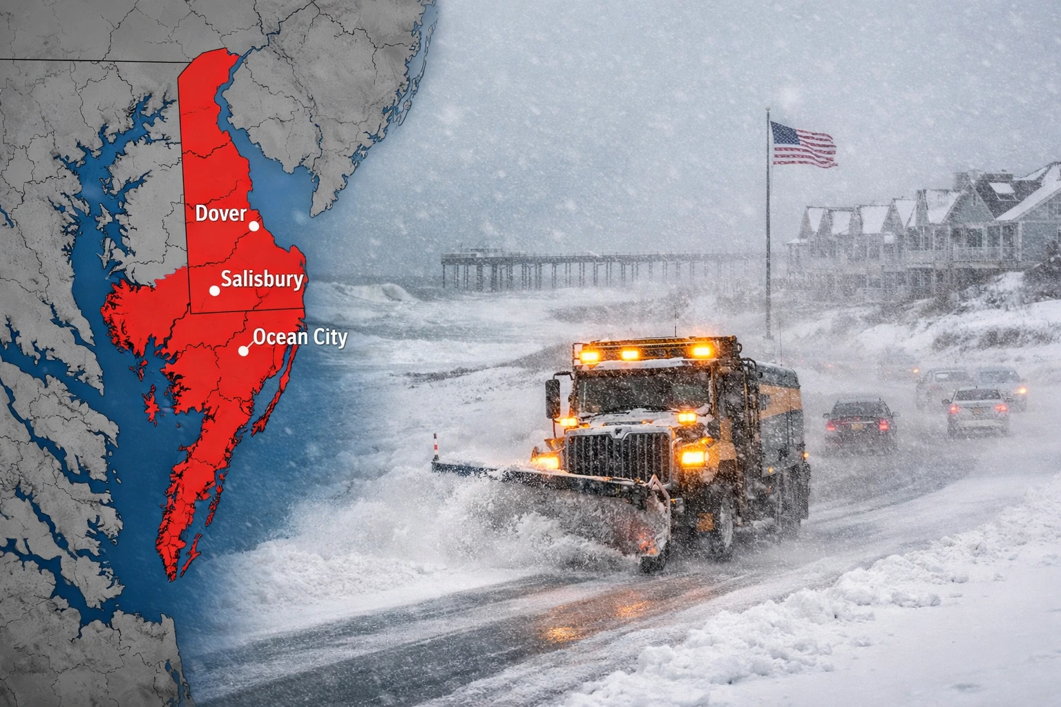
The National Weather Service has issued a blizzard warning for the Delmarva Peninsula, warning of heavy snowfall, strong winds and near zero visibility through 6 PM Sunday, according to the agency’s Mount Holly office in New Jersey.
The alert covers Delaware and Maryland’s Eastern Shore and is expected to create hazardous travel conditions and potential power disruptions across the region.
The blizzard warning issued by the National Weather Service signals one of the most significant winter weather threats of the season for the Delmarva Peninsula, a low lying coastal region particularly vulnerable to wind driven snow and coastal gusts.
The warning, first activated early Saturday morning by the agency’s Mount Holly forecast office, underscores the likelihood of sustained blizzard conditions lasting into Sunday evening.
Meteorologists define blizzard conditions as sustained winds or frequent gusts of at least 35 mph combined with falling or blowing snow that reduces visibility to one quarter mile or less for at least three consecutive hours.
The Delmarva Peninsula encompassing Delaware, Maryland’s Eastern Shore and parts of Virginia often experiences complex winter systems due to its coastal geography between the Atlantic Ocean and the Chesapeake Bay.
Moisture from the ocean can intensify snowfall totals when paired with cold continental air.
According to historical data from the National Weather Service, prolonged blizzard warnings are relatively uncommon for the region compared with northern states.
The extended duration of the current alert raises concerns about compounding impacts, including drifting snow and infrastructure strain.
Emergency management agencies in Delaware and Maryland began coordinating road treatment and utility response operations late Friday as forecast confidence increased.
Blizzard Criteria vs. Forecast Conditions
| Criteria / Forecast Element | Blizzard Threshold | Current Forecast Range |
|---|---|---|
| Sustained wind | ≥ 35 mph | 35–45 mph gusts |
| Visibility | ≤ 0.25 mile | Near zero at times |
| Duration | ≥ 3 hours | Several hours possible |
| Snow accumulation | Not specified | Heavy snowfall likely |
Source: National Weather Service Mount Holly forecast briefing
Sarah Johnson, meteorologist at the National Weather Service Mount Holly office, said the combination of wind and snow presents the greatest concern.
“This is not just a snowfall event,” Johnson said. “The sustained winds will cause blowing and drifting snow that can quickly make roads impassable even after plowing.”
Brian McCarthy, a climate and resilience researcher at the University of Delaware, said coastal regions such as Delmarva face heightened risk when strong pressure gradients develop offshore.
“Wind driven snow in flat terrain can create whiteout conditions rapidly,” McCarthy said. “The longer duration increases stress on transportation networks and emergency services.”
Delaware Emergency Management Agency Director A.J Schall said state crews were pre-positioned across major highways.
“We are urging residents to avoid unnecessary travel during the peak of this blizzard warning,” Schall said. “Visibility may drop to near zero within minutes.”
Maryland State Highway Administration spokesperson Charlie Gischlar said road crews are operating in rotating shifts to maintain continuous snow removal.
“Prolonged wind will undo some of our clearing work,” Gischlar said. “Drivers should expect rapidly changing conditions.”
Forecasters expect conditions to gradually improve late Sunday as the storm system moves offshore, though blowing snow could linger into early Monday.
Officials said recovery efforts, including road clearing and power restoration, may extend beyond the expiration of the blizzard warning.
Residents are advised to monitor official updates from the National Weather Service and local emergency agencies as conditions evolve.
The blizzard warning for the Delmarva Peninsula highlights the potential for sustained, high-impact winter weather across a coastal region unaccustomed to prolonged whiteout conditions.
With heavy snow, strong winds and limited visibility expected through Sunday evening, authorities continue to stress preparation and caution as communities navigate what could be the most disruptive winter storm of the season.
NOTE! This article was generated with the support of AI and compiled by professionals from multiple reliable sources, including official statements, press releases, and verified media coverage. For more information, please see our T&C.