SUMMARY
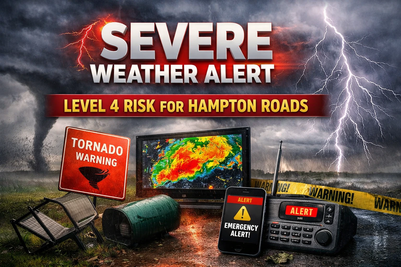
- A rare severe weather risk level four of five has been issued for inland parts of Virginia and North Carolina ahead of Monday’s storms.
- Forecasters expect two potential rounds of thunderstorms with damaging winds and tornadoes as primary threats Monday afternoon and evening.
- Residents are urged to secure outdoor items, monitor weather alerts and identify safe shelter locations before conditions deteriorate.
Forecasters warned Sunday that a rare level four of five severe weather risk could bring damaging winds, tornadoes and large hail to communities across the Hampton Roads region of Virginia and northeastern North Carolina on Monday, prompting officials to urge residents to prepare for multiple rounds of storms.
Meteorologists said the elevated severe weather risk reflects an unusually strong spring system moving across the Mid Atlantic, combining warm moist air, strengthening winds and an advancing cold front that could trigger widespread severe thunderstorms.
Sunday conditions were expected to remain mostly dry with temperatures in the mid 60s and increasing clouds ahead of a warm front expected to lift north later in the evening.
Scattered showers and isolated thunder were forecast overnight as the boundary moved through, though the primary severe weather risk is expected Monday.
“The atmosphere will become increasingly unstable Monday as warmer air and strong wind energy build across the region,” said Brian Hurley, senior branch forecaster at the National Weather Service Weather Prediction Center.
He said the setup raises the possibility of organized severe storms capable of producing tornadoes and damaging straight line winds.
Kristina Pydynowski, senior meteorologist at AccuWeather, said the combination of wind shear and warming daytime temperatures could increase the severe weather risk if sunshine develops between storm rounds.
Local emergency managers urged residents to review safety plans and keep phones charged as strong southerly winds may gust above forty five miles per hour.
“Having multiple ways to receive warnings is critical during a high end severe weather risk,” said Mary Thompson, emergency management coordinator for the Hampton Roads Planning District Commission.
The storm system is expected to move offshore late Monday night allowing cooler and drier air to spread across the region.
High temperatures could fall from the mid 70s Monday to the upper 40s by Tuesday before gradually warming later in the week.
Officials said preparedness could reduce risks as the severe weather risk unfolds Monday.
NOTE! This article was generated with the support of AI and compiled by professionals from multiple reliable sources, including official statements, press releases, and verified media coverage. For more information, please see our T&C.